Monday, April 25, 2011

Another week of studying and memorization complete...

I've managed through repetition and memorization to lock down the order of battle from the entire 1st Corps through the 2nd Division of the 2nd Corps down to the regimental level.  It's amazing how much you can absorb when you put your mind to it.

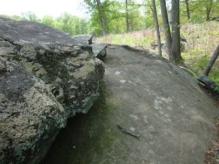
Recently (earlier this month), I was in Gettysburg and managed to find my way up to Neill Avenue (also called Lost Lane).  There is a narrow goat path that leads from a dead end street, down to a stream bottom, and back up a steep hillside.  The route to the area isn't marked anywhere that I am aware of, and it is not handicapped accessible.  The trail is about 8-10' wide and is bordered by private property.  This I know because the landowner managed to hang "No Trespassing" signs on just about every tree that bordered the trail.  The area of Neill Avenue is the extreme right position of the Union Army at Gettysburg.  Here are some pictures I took, enjoy.


This is the original marker for Neill Avenue, visible in the second picture on the right hand side.

The view from the beginning of Neill Avenue.  Note that the property on either side is privately owned.

Neill Avenue is actually in a couple of parts along this ridge line.  This area has a wire across either end, possibly to impede horse traffic as there were a lot of tracks in the area and on surrounding trails.  A few hundred yards beyond this picture is a second area with monuments.


This is the monument to the 49th NY Infantry on the lower end of Neill Avenue, they were in the 6th Corps and assigned to this position on the 3rd of July, 1863.


This next monument I really took a shine to.  I really like the "Union Shield" design of it with the 6th Corps insignia in the middle.  This monument is to the 7th Maine Infantry who were also assigned here on July 3rd.

Looking downhill on the right hand side you can see the 7th Maine Monument, and close to center you can see the monument to the 49th New York.


A little further up Neill Avenue and to the left we find a monument to the 43rd New York Infantry, they were assigned here on the 2nd of July.  They had an impressive battle history including the Peninsula Campaign, the 7 Day's Battle, Antietam, Fredericksburg, Gettysburg (obviously), Grant's Overland Campaign, Petersburg, and Appomattox (to name a few)


Just a few steps from the 43rd NY Monument is a marker for the 3rd Brigade, 2nd Division of the 6th Corps.


Looking back down at the first section of Neill Avenue you can see the 3rd Brigade marker and the 43rd NY Monument.

Nearing the end of Neill Avenue (the second part of it) we approach the monument to 61st Pennsylvania.  They held the position of the extreme right of the Army of the Potomac at Gettysburg.  After marching 37 miles, they arrived at Gettysburg on July 2, 1863 and were assigned to assist the 12th Corps, they were moved to this position on the morning of July 3rd. 


 Finally we reach the marker denoting the extreme right of the Army of the Potomac.  The little stone marker on the right is a flank marker from the 61st Pennsylvania.  You can tell where the Park Service property ends by the "No Trespassing" sign on the tree in the background.  Maybe it's me, but if you own property in a historic area, shouldn't you be willing to accept that people are going to want to be there?

Tuesday, April 19, 2011

The memorization by repetition process continues, I'm 100% with the 1st Corps, and am through the 1st Division of the 2nd Corps (with 100% accuracy).

For the record my reading and listening list these days are rather short...
I'm presently reading Gettysburg The First Day by Pfanz, and listening (on my IPOD) to Gettysburg by Sears.

If you're interested there are several great books out there on the topic...The Gettysburg Campaign (A Study in Command) by Coddington; any of the Gettysburg series by Pfanz; for battlefield knowledge a new book that has only been out for a year or so is The Complete Gettysburg Guide by Petruzzi and Stanley.

There are also several websites out there that are a great reference...

Gettysburg Daily http://www.gettysburgdaily.com/  (a site run by several licensed battlefield guides), this site has a wealth of information specifically on the battlefield and surrounding area;

The Battle of Gettysburg Resource Center http://gburginfo.brinkster.net/index.htm; it's not updated often, but has a lot of basic information to get you started.

The Civil War Trust http://www.civilwar.org/welcome/ (formerly the Civil War Battlefield Preservation Trust); this group's focus is battlefield preservation, they are a great charity and use donations to purchase threatened battlefield properties to ensure availability for future generations, they also have great maps and additional information on battles.

and Stone Sentinals http://www.stonesentinels.com/, they have pictures and information on the monuments of several battlefields.

There are others that I go to as well, and in the future I will add information on those sites as well.
Happy studies.

Saturday, April 16, 2011

More period graffiti from Gettysburg...

My studies are progressing, and I'm most of the way through the 1st Division of the 2nd Corps...but nice weather and my motorcycle are both calling out to me.

Anywho, here are some more pictures and descriptions of period graffiti from the Gettysburg Battlefield.  As I said in my last post, the pictures posted here are ones I have taken myself.

These first two are from the George Spangler Farm, they are on the out building that General Armistead was taken to after being mortally wounded during Pickett's Charge.  I'm not sure the time frame that they are from, but this is from a not very widely traveled part of the battlefield, in fact when the pictures were taken was right after the park service took ownership of these buildings.  The first one is on the door to the building, the second picture is of the windowsill.  


This next one is by the 40th NY Memorial below Devil's Den and next to the Valley of Death, it is believed to predate the 1888 dedication of the 40th NY memorial.


This is taken atop a large boulder in the area of the Valley of Death...experience being hindsight, don't try climbing up here to take this picture unless you have somebody to help you down (getting up there was the easy part)...what you're looking at is a very faint outline of the US Flag, the rock is known as Flag Rock conveniently.  There is another carving up there, the initials UFS 1873.


Just inside Devil's Den near the 4th Maine memorial is this engraving to the 4th Maine.  Now quite easy to find and darned near in plain sight, this was "rediscovered" in 1993 by Licensed Battlefield Guide Timothy Smith after brush was cleared from the area.


 This one is in plain sight across from the Irish Brigade Memorial (by the memorial plaque to the 28th Massachusetts Field Hospital), it's easy to miss though.  Not sure who PB is...
This is the same rock from a distance...can you see the PB?


This next rock is the David Acheson Rock.  Acheson was a Captain with the 140th Pennsylvania Infantry, he was killed in the Wheatfield, he was buried just inside the woodline at the Weikert farm and the stone was marked with his initials and regiment so his family could retrieve the body at a later time.  His remains were returned to Washington County (Pa) about 2 weeks after the battle.

This next mark is next to the NY memorial on Little Round Top and is dedicated to Col. Strong Vincent who was mortally wounded near here. (Vincent was promoted to Brigadier General for his actions on Little Round  Top)

Over by Spangler Spring is the "Coble Rock", this one is fairly well known and is inscribed with "AL Coble 1st NC REG"
Private Augustus Lucian Coble served w/ Company E, 1st North Carolina Infantry as a color bearer during the battle.  It is believed that in 1913 at the 50th reunion of the battle, he made this marking.
A wide shot of the Coble Rock.


The Daniel Lady Farm on Hanover Road was used as a field hospital for Ewell's Corps, carved on a beam in the barn are 2 sets of initials, this first reads, "BAR, 23VA" and has been identified to Private Benjamin A Roberts, from Company K of the 23rd Virginia Infantry.


The second carving at the Daniel Lady Farm reads, "ABE 3NC" and has been identified to Private Aaron E Eubanks, Company G of the 3rd North Carolina Infantry

Tuesday, April 12, 2011

The studying is ongoing and I can comfortably say I know the order of battle for the 1st Corps to the regimental level, and now I start studying the 2nd Corps.

One of the things I enjoy doing at Gettysburg (in particular) is finding period graffiti on the battlefield.  Some (like Coble Rock by Spangler's Spring) are well known, others, not so much.  Devil's Den was so covered with graffiti that when the Park Service finally obtained the property, they had to chisel much of the rocks there to remove it (look for period photos and you'll see what I mean).

For your viewing pleasure, here is some period graffiti that I've found (using reference material) on the battlefield.  For the record all pictures shown in this post were taken by yours truly.


This one is on the south wall of the McPherson Barn, if you can't make it out it reads:
JCT 143 PV
SMG Sept 12 1889
This one was found in 2004 by the son of a battlefield guide.  THe carvings are traced to Jonas C Tubbs and Singleton M. Goss.  Tubbs was a private when taken prisoner on the first day of the battle, Goss was a drummer boy who served throughout the war.


Again this is one not too many people see, mainly because this is from one of the less famous areas of the battlefield (not to mention the steep uphill walk to get here).  These are atop of Big Round Top.  They may not all be visible in this picture, but the names are:  J. Noble; J. Hinchcliff; J.Crumlish; and the initials WHG and WHH.
The identities aren't all known, but Hinchcliff and Crumlish are names of personnel who served in the Union Army, but weren't with units that fought at Gettysburg, maybe they were there for a reunion after the war?


This is up on Little Round Top, kind of in a hidden place but in plain sight (if you know where to look).  This is behind the 91st Pennsylvania Monument.  It commemorates the spot where Brigadier General Stephen Weed and Lt. Charles Hazlett died.  It's very faint, but reads as follows, "C. E. Hazlett Fell / Com'g Batt'y D U.S. Art'y in Battle / July 2nd 1863"


These next two I found on the Henry Spangler Barn while exploring last year.  I've never seen them written up anywhere, but that probably means I'm not looking in the right places.  They are period, but I have no clue who they are related to.  They read as follows:  "C.A.S. (reversed S) 1871" and what to me looks like "C. SP. 1875"


That's it for today, I'll post more pix later this week.

Saturday, April 09, 2011

Use it or lose it...
I'm presently in the process of trying to learn the order of battle...
I was doing really well, I had locked down the 1st Corps in about a week.  Well I took a week off (vacation) and stopped doing the memorization drills that worked so well for me in paramedic school.
I literally lost about 1/3 of what I had known cold.
I did get to go to Gettysburg for 2 days though, so it's a trade off.
After a big step back, I have rebounded, and am now working on learning the 2nd Corps.

I will post pix from my trip tomorrow (or later tonight)

Sunday, April 03, 2011

Ahhh Gettysburg...
I just returned from a trip to Gettysburg earlier this week.  My friends's son was in town from Spokane as a graduation present.  Wracking my brain trying to come up with entertaining things to do, I asked if he'd ever been to Gettysburg (or was even interested in it), he told me he loved all things Civil War, so we did 2 days in Gettysburg and 1 at Antietam.

The weather wasn't conducive to a lot of outside time, but that didn't deter us.

We spent the next 2 days exploring the battlefield at Gettysburg.  It was interesting for me to try to see Gettysburg through Joe's eyes as this was his first visit.  We walked Pickett's Charge (and retreat), up Big Round Top, all over Culp's Hill, the Bloody Wheat Field and the Peach Orchard.  Joe indulged me as I was looking for an area I had never been to (Neill Avenue, also called Lost Lane) on Wolf's Hill.  Following a poorly copied map and directions we eventually found it.  We explored the rocks at Devil's Den and walked part of the Triangle Field.

When we were done, our legs were like jello and our feet blistered.  And on we went.

We continued to Antietam Battlefield for a "day" trip.  I won't go into detail about that here though.  Maybe later.

My next post will have pix from this Gettysburg trip.